Object detection is a prominent and well-researched topic in the field of computer vision. This study seeks to contribute to the field by tackling the overall issue of object detection, with an added layer of complexity through the types of images on which the object would be detected.
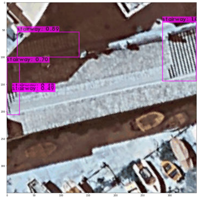
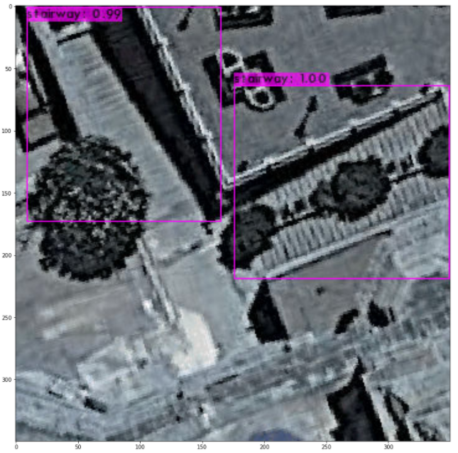
A working definition of ‘stairways’ would be: “a set of stairs inside or outside a building”. This study focused on building a detector of stairways located outside buildings and outdoors stairways in urban areas across the Maltese Islands. Due to the niche nature of the study topic, it was necessary to split this project into two major sections: data acquisition and experimentation.
The data acquisition aspect was tackled by obtaining images of stairways from various towns and public areas around the Maltese Islands. In total, around 10,000 images with varying rotations and zoom levels, randomised stairway positioning and lighting conditions were obtained through the use of a Google Maps API.
The aim of the other major aspect of this study – the experiments –was to document and seek to achieve the best metrics possible for this kind of object detection, as well as studying the impact of varying sub-datasets from the origins dataset. The scenarios ranged from experimenting with different state-of-the-art object-detection methods and differences in the datasets, to the evaluation of false positives that were obtained by the algorithms.
The significance of this study lies in the ability to integrate it into practical tasks, such as accessibility of public places and possibly routing. It proposes a comprehensive stage-by-stage process towards achieving an accurate object detector for aerially captured stairways. The study also explores and demonstrates the impact of various components that have long been problematic within the field of computer vision.
Course: B.Sc. IT (Hons.) Artificial Intelligence
Supervisor: Mr Dylan Seychell
Co-supervisor: Mr Mark Bugeja