Traffic congestion is currently one of the major problems in Malta and has a negative impact on the country in terms of the economy, the environment and society in general. It has been established that congestion largely occurs at certain peaks, which mostly coincide with office and school hours. Nevertheless, when taking into account that the traffic flow is acceptable at other hours during the day, widening the roads and seeking to improve the infrastructure of the current road network merely to cater for peak hours is not necessarily the optimal solution.
This study proposes to reduce traffic congestion in Malta by relocating major buildings such as schools and hospitals from their current location to other areas. This could be achieved by using simulation techniques to analyse current data towards gaining insight into the effects such relocations would have on the road network. The proposed new locations were selected on the basis of current non-congested areas and focusing on main roads outside the congested town centres. The goal was to shift traffic outside the town centre, whilst maintaining the main road traffic as free-flowing as possible, thus leading to a positive impact on the environment in the living area of the general population.
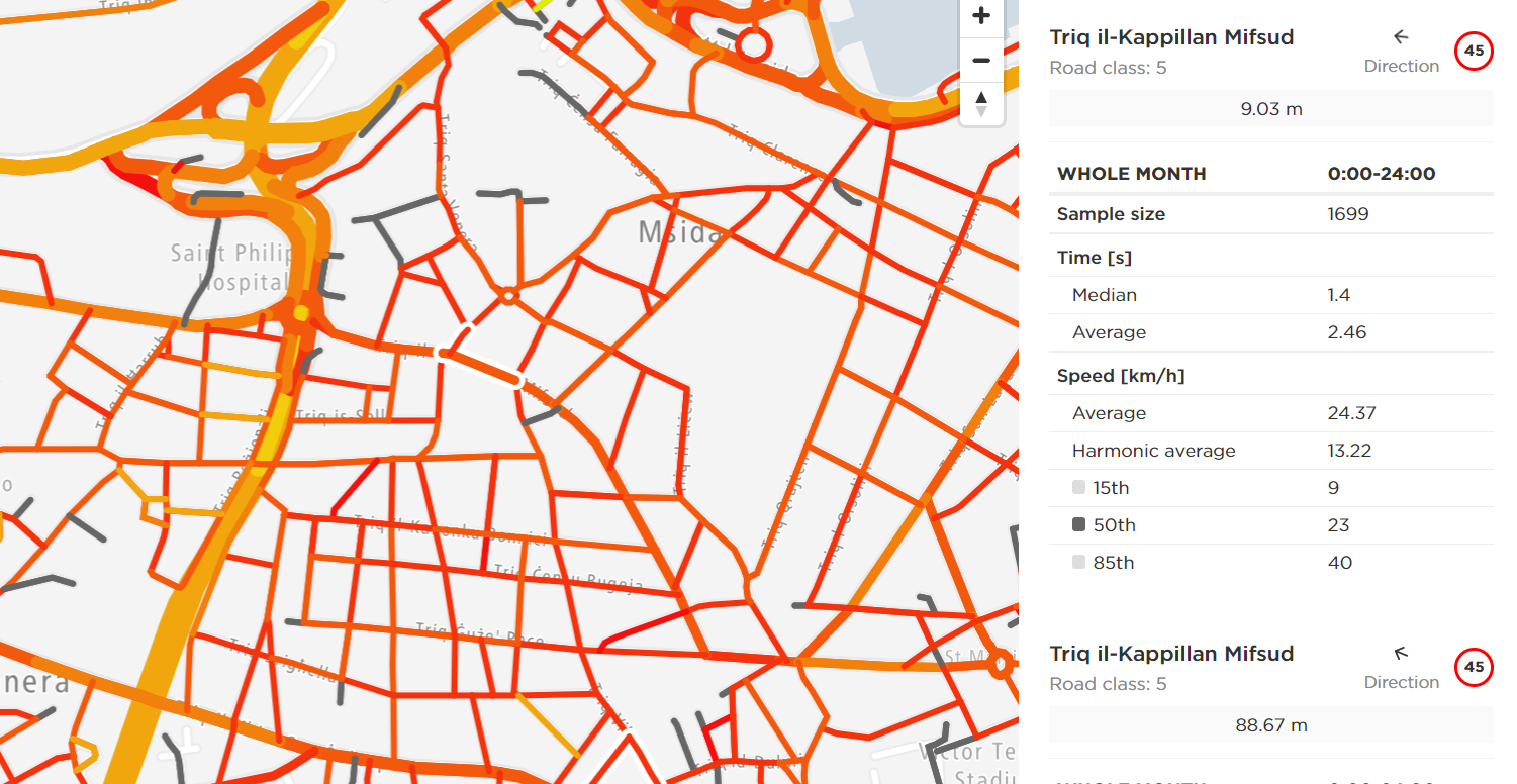
Data relating to traffic congestion was obtained from TomTom, which provides historical traffic maps. TomTom indicates the vehicle density in a particular part of the road, with the respective date and time. A sample is shown in the accompanying image. The data obtained was then used to create the proposed simulation models. The simulation software Simul8 was used for recreating different scenarios of the relocation of such major buildings. Traffic data obtained using the simulation technique was compared with the old and proposed locations, following which an analysis on the effects of each site was conducted.
Multiple scenarios were implemented, including the change in location of the building, taking into consideration at least three different new locations. Another scenario was to identify another major building within a different category, in the same area and relocate it as well. This scenario was simulated both as a standalone and also in conjunction with the previous building. An analysis of the results and comparisons between the different scenarios was carried out.
At the final stage, the feasibility of the solution was assessed in terms of whether it would be effective to relocate such buildings, and the significance of the results obtained, alongside other considerations. Recommendations for possible implementation were made on the basis of the achieved results and subsequent evaluation.
Course: B.Sc. IT (Hons.) Software Development
Supervisor: Dr Lalit Garg